Moanalua Valley Trail to the Haiku Stairs (The Legal Way)
Also called the Stairway to Heaven, the Haiku Stairs is a rusty, dilapidated stairway that tracks along several ridgelines to an abandoned WWII era radar/radio station overlooking Honolulu. The route up is sketchy, as the staircase is falling apart and the ridge underneath it eroding, but you’re rewarded -on a clear day -with what some say are the best views on the entire island. You may also be rewarded with a thousand dollar fine (and maybe a tetanus shot) if you’re caught on the stairs, since it’s been illegal to climb them for years. There is a way to reach the top of the ridge though, through a mostly legal way, and that’s by hiking up the Moanalua Valley Trail. This trail is around 10.5 miles long and can be quite challenging. The first three miles are totally flat, but after that it’s basically straight up to the top of the ridgeline.
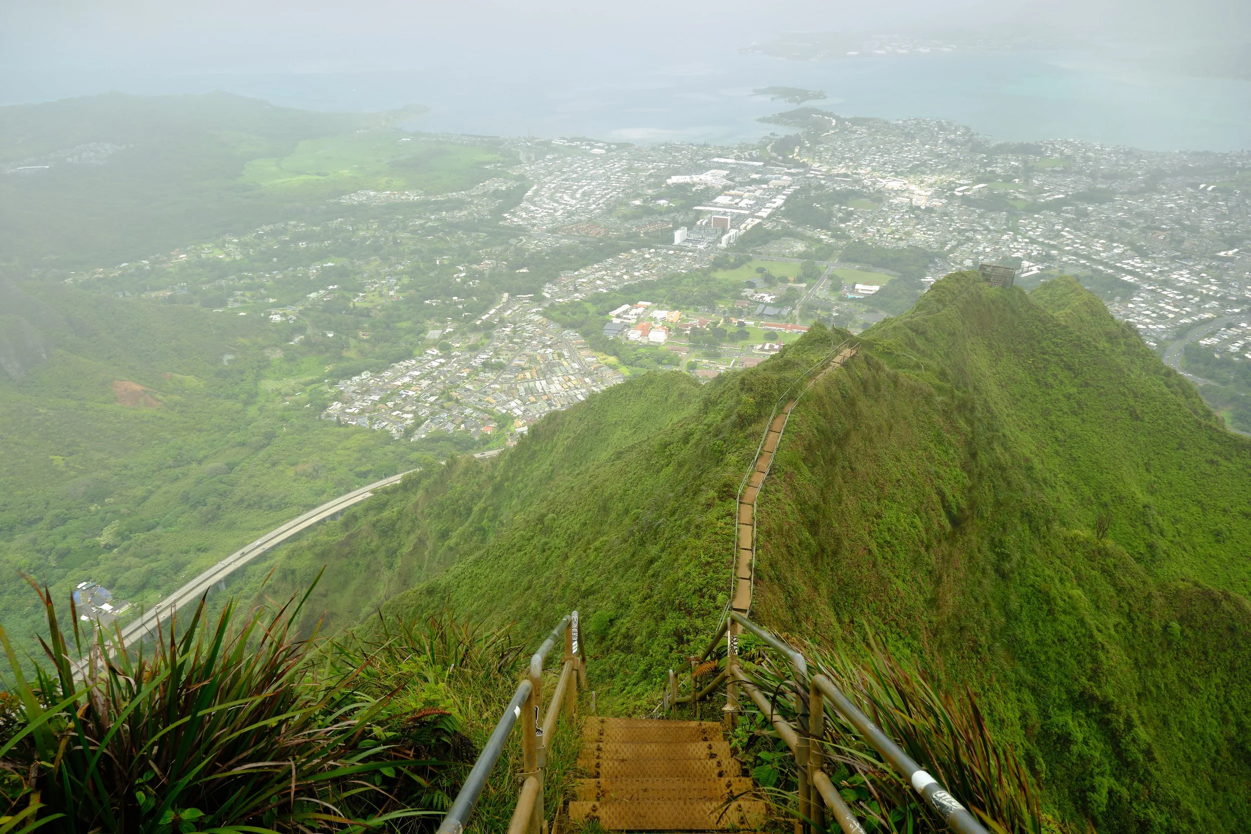
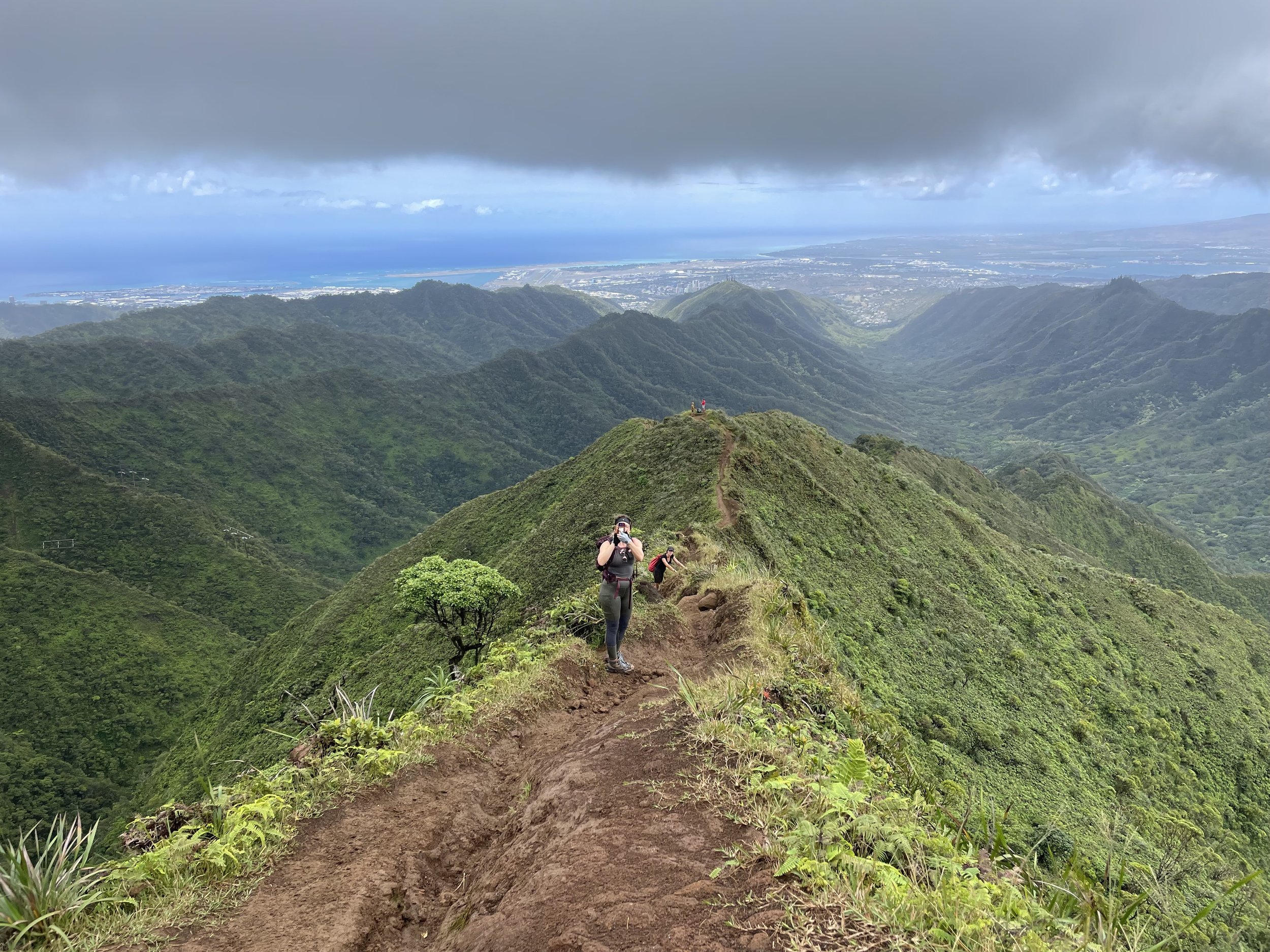
View from the top, just below the radar station.
Stepping onto the grounds of the radar station at the top, or continuing onto the stairs is still illegal, but the odds of getting caught can be pretty slim if you’re smart about it. Snap a few photos and be on your way, and you should be ok. The view can be tremendous…IF the weather cooperates. It was sunny when we started the hike, but by time we starting the ridge climb, the clouds had moved in wrapping us in mist and rain, graying out most scenery. We waited around a bit at the top and the clouds parted for a few minutes, not letting the much sun through but at least letting us snap a few decent photos of the city below.
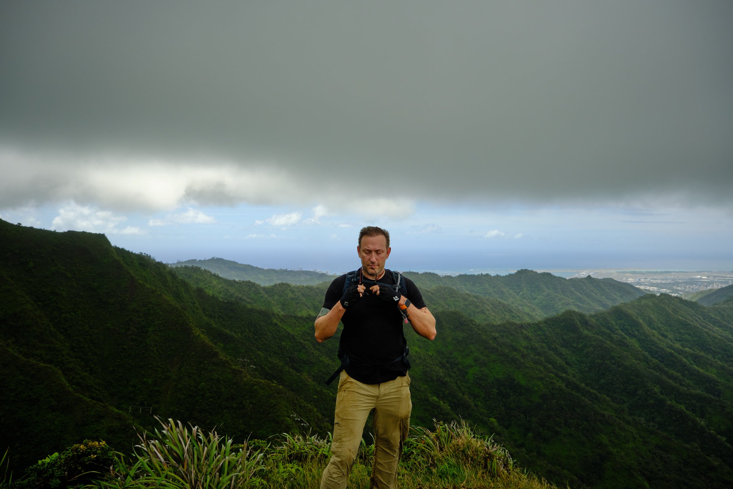
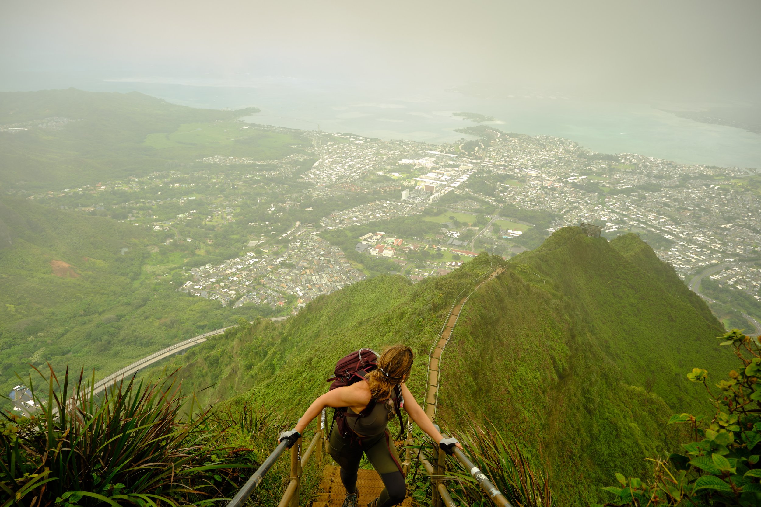
Perfect time for a selfie.

Haiku Stairs
Is the hike as challenging as they say? Yeah, pretty much. If there has been rain the day before or day of, it will muddy and slick. If you’re not prepared for this you’ll be pretty miserable. There are several spots on the trail that are more akin to rock climbing than hiking, with ropes to help make your way up. These spots are bottlenecks, especially on a busy day. The trail was pretty quiet the day we hiked, but we still had a half hour or so wait at one of these points.
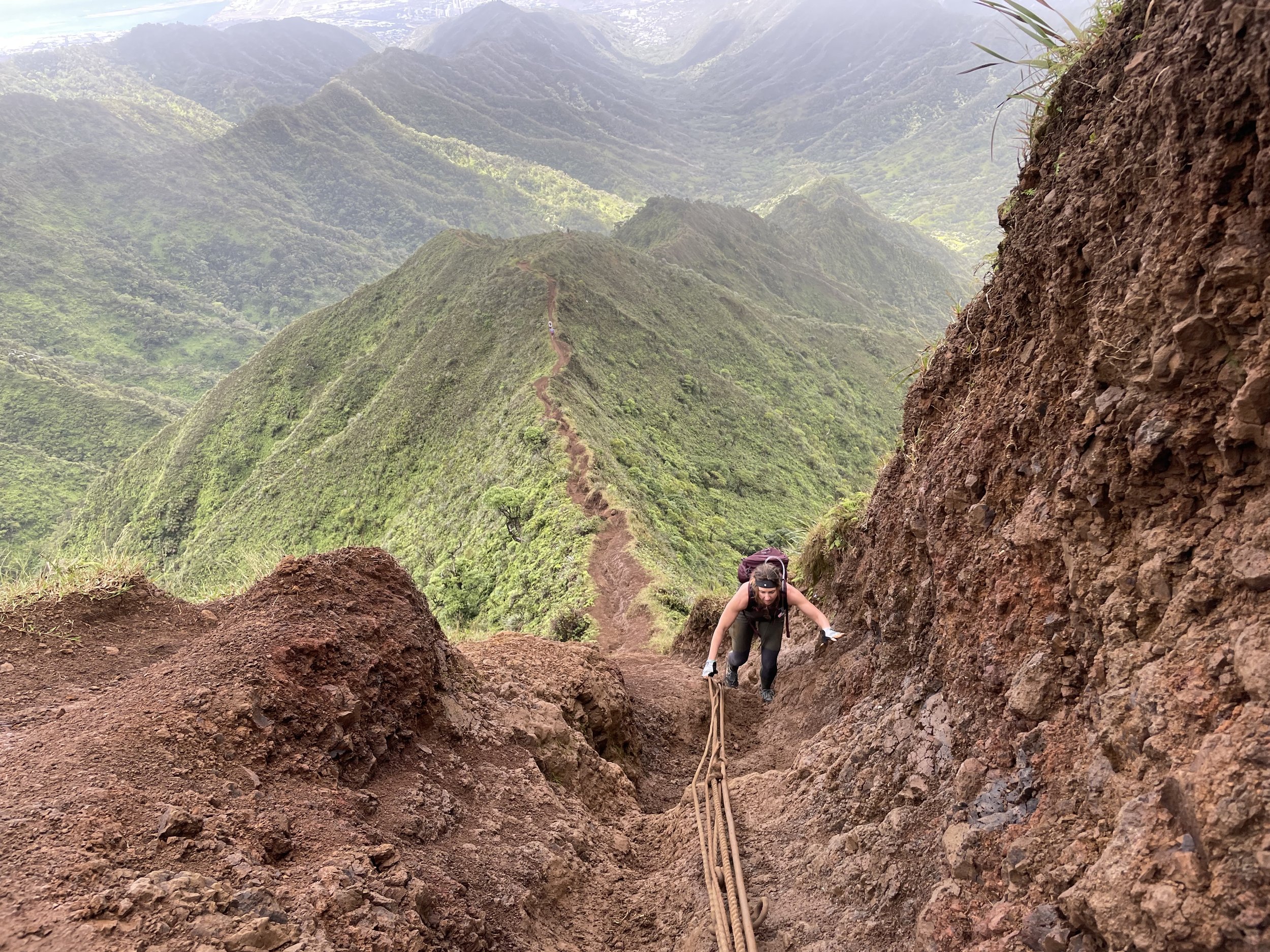
The way up.

All that Crossfit finally paying off.
Abandoned radio tower. Can you hear me now?

Star Wars vibes at the top.
Don’t like mud and getting dirty? This isn’t the hike for you.
Don’t like heights and narrow paths lined by steep drop-offs on both sides? Stay home and drink a few Mai Tais.

Moanalua Valley Trail

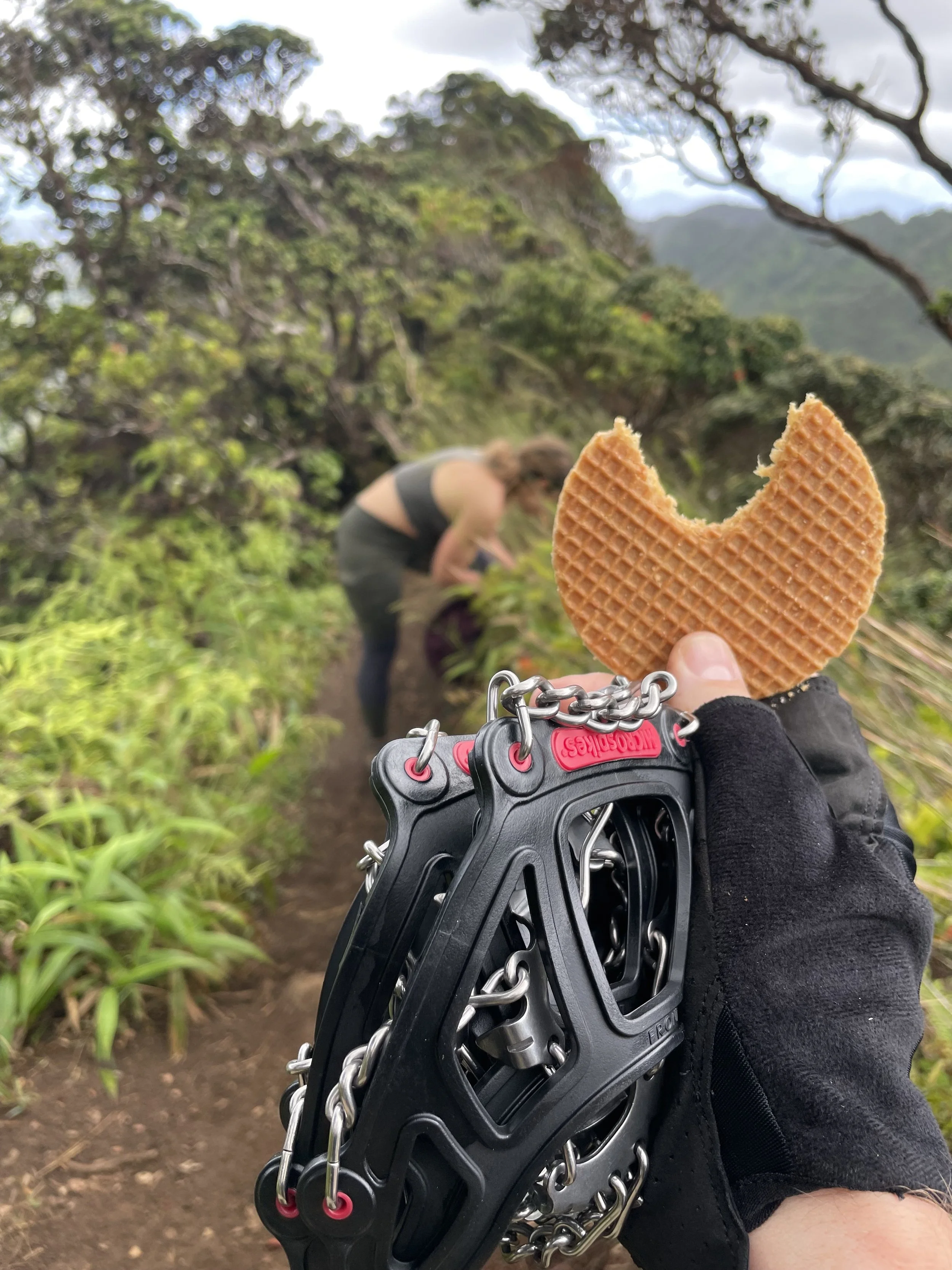
Microspikes and stroopwafels
Where to Go/Park: The trailhead is in the Moanalua Valley Neighborhood Park. There’s a parking lot and on a slow day you can probably get away with parking there, but keep in mind the gates are locked at 7pm whether you are back or not. Another option is to park on the street, where there are plenty of spots. Make sure you don’t block anyone in, park where indicated by the signs, and be respectful (read: quiet) when parking and you won’t have any problems.
Once you enter the park, you’ll walk through the parking lot up a trail with the playground on your right. You’ll come to a gate that you have to walkaround and see some signage about cleaning your boots to minimize the spread of invasive plants. You’ll go straight on this trail for almost 3 miles.

The path for the first three miles.
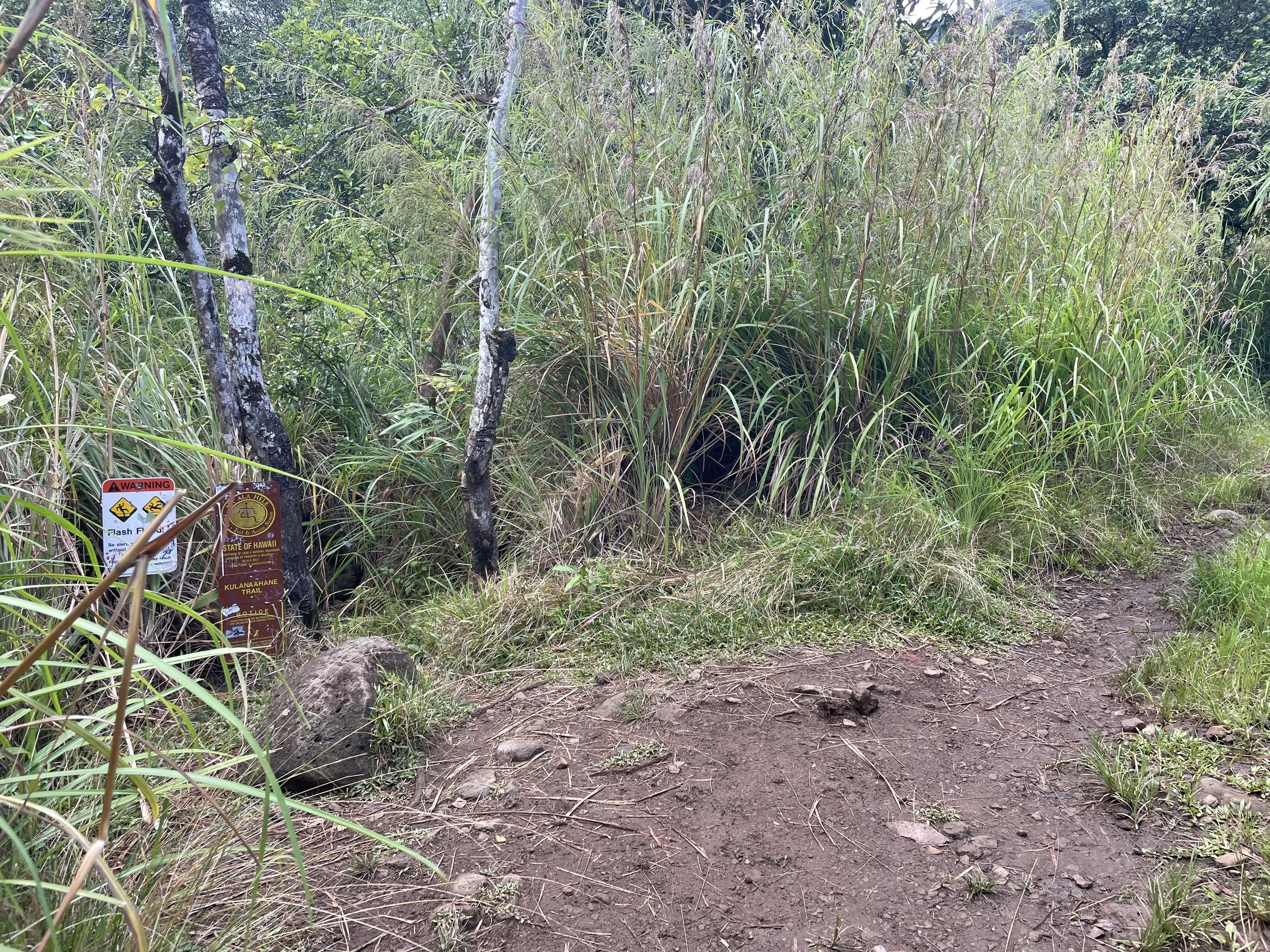
I’ll say that part again: you’ll go straight for almost three miles. There will be dozens of little cut-outs and turn offs, some of them “marked” with pink tape, or brown tape, or white tape that used to be pink or brown tape. Ignore these, and keep going. If, before three miles, you find yourself starting to climb, you’ve gone off trail. You’ll be looking for this yellow sign:
Once you see that sign you go slightly to the right for about 20 feet and there will be a path on your left across the dry riverbed; that’s the path you’ll follow. You’ll start to climb up almost immediately from that point on. You can also walk just to the right of the sign and turn right onto the riverbed then follow the trail from there too.
If you don’t start to climb up within one or two minutes of reaching the yellow sign, you’re off the correct path, go back to the sign and regroup. If you reach a green outhouse-shaped electrical building (like we did) it means you somehow went left instead of right (derp). Go back to the yellow sign and then (looking at the front of the sign) go to the right. It’s not hard to find, especially if you have the alltrails app.
Speaking of the alltrails app, you can download the Moanalua Valley Trail Hike before you head over there. If you’re using it, it’s pretty exact, so if there is a point you find yourself diverging from the gps path’s on the app, circle back and get back on track. There’s very limited cell service so do this before you head out for the day.
What to Bring: Microspikes!! These make the extreme vertical spots so much more stable/easier. You can find a cheap pair online, or by at a climbing store locally for a lot more money. We brought ours in our carryon and didn’t have any issues on there way there or back with TSA. It rained periodically during the hike, and people were sliding around dangerously up and down the ridge, while we trudged along confidently. Gloves - you don’t really need them but they are nice to have if it’s muddy to get better grip on the assist ropes.
Water: I would recommend 2.5-3 liters to make sure you have plenty to drink. It will be hot and swampy, and if it’s sunny you wont have any shade for as least half of the hike. The entire ridgeline is completely exposed.
Otherwise, you don’t need anything special for this hike, just the usual items for 6-8 hour hike: snacks, a rain poncho or light waterproof jacket, bug spray, sunblock. This is a great way to see some fantastic views of the island,

Behind the scenes shot.